Results 1 to 9 of 9

Thread: Garmin 60CSx Whiz

  1. #1
    Member
    Join Date
    Jan 2008
    Posts
    326
    Thanks
    5
    Thanked 47 Times in 24 Posts
    Rep Power
    222
    Reputation
    681

    Default Garmin 60CSx Whiz

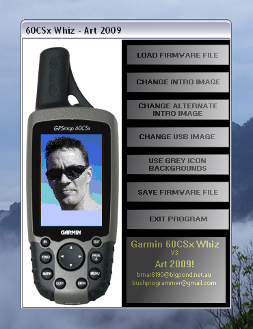
    Garmin 60CSx Whiz


    Hi Guys,
    Here's an all in one program that combines some of my previous efforts
    into a single polished program.
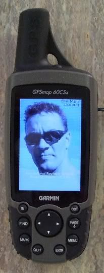
    This will allow you to add custom intro screens, icons, and USB graphic
    to the Garmin 60CSx GPS.

    Example images with the correct colour palette are supplied in the program package.
    Please read program instructions before use.


    Download links:


    Enjoy
    Cheers, Art.


Look Here ->
  • #2
    Junior Member
    Join Date
    May 2009
    Location
    Far North Qld
    Posts
    4
    Thanks
    0
    Thanked 0 Times in 0 Posts
    Rep Power
    0
    Reputation
    10

    Default

    Hey Art.
    I have recently bought a 60csx with a marine sd card( do a bit in the brine in fnq) Im pretty new to all this , but wondering what you think of the best Aust sd card for all Aust cities and Topo (with good detail)
    I'd appreciate a comment or two.
    Cheers.
    Pughead

  • #3
    Member
    Join Date
    Jan 2008
    Posts
    326
    Thanks
    5
    Thanked 47 Times in 24 Posts
    Rep Power
    222
    Reputation
    681

    Default

    For Topographic detail, OzTopo V2.1 is here:


    For street detail, City Navigator NT 2009 is here:


    City Navigator NT products are compressed, and play up on my 60CSx when routing through
    dense suburbs, so you may want to try the plain City Navigator 2008, only you'll need
    to use a torrent client to download this one:


    Art.


    Seems first post can't be edited. Newest version of 60CSx Whiz here:

  • #4
    Senior Member puca's Avatar
    Join Date
    Jan 2008
    Age
    61
    Posts
    1,495
    Thanks
    785
    Thanked 306 Times in 150 Posts
    Rep Power
    284
    Reputation
    1817

    Default

    hay art a quick question i have the astro 220 which is a dog tracking unit it appears identical to your unit do you think your program would run on it
    IF IT DONT WORK USE A BIGGER HAMMER

  • #5
    Member
    Join Date
    Jan 2008
    Posts
    326
    Thanks
    5
    Thanked 47 Times in 24 Posts
    Rep Power
    222
    Reputation
    681

    Default

    No, it has different firmware, the images would be at different offsets.
    My program would kick you out for incorrect firmware version error.

    Interesting though. I've never seen one till I searched just then.
    Firmware for it isn't on the Aus Garmin update page... must be American.

  • #6
    Senior Member puca's Avatar
    Join Date
    Jan 2008
    Age
    61
    Posts
    1,495
    Thanks
    785
    Thanked 306 Times in 150 Posts
    Rep Power
    284
    Reputation
    1817

    Default

    yeah they are only sold in the states because they use vhf for tracking some crap about ham freq being interfered with like in the middle of whop whop its going to matter oh well was Worth a shot good work by the way
    cheers puca
    IF IT DONT WORK USE A BIGGER HAMMER

  • #7
    Junior Member
    Join Date
    May 2009
    Location
    Far North Qld
    Posts
    4
    Thanks
    0
    Thanked 0 Times in 0 Posts
    Rep Power
    0
    Reputation
    10

    Default

    Quote Originally Posted by Art View Post
    For Topographic detail, OzTopo V2.1 is here:


    For street detail, City Navigator NT 2009 is here:


    City Navigator NT products are compressed, and play up on my 60CSx when routing through
    dense suburbs, so you may want to try the plain City Navigator 2008, only you'll need
    to use a torrent client to download this one:


    Art.


    Seems first post can't be edited. Newest version of 60CSx Whiz here:
    Thanks for this advice,
    I'll go with these two, I heard the new version of oztopo is good.
    Cheers Pughead

  • #8
    Member
    Join Date
    Jan 2008
    Posts
    326
    Thanks
    5
    Thanked 47 Times in 24 Posts
    Rep Power
    222
    Reputation
    681

    Default

    Shame you got the marine maps on a card.
    You'll be having to swap cards for street/hiking and marine use.

    There is a CD version of bluechart floating about here too.
    It might be of use so you can fit it all on one micro SD.
    It is possible to fit CN, oztopo and most of bluechart on a 2Gb card
    all at once.

  • #9
    Member
    Join Date
    Jan 2008
    Posts
    326
    Thanks
    5
    Thanked 47 Times in 24 Posts
    Rep Power
    222
    Reputation
    681

    Default

    Can't seem to edit my first post so....

    Updated to (also) work with latest firmware version 4.00

    YouTube Demo Video of modified Garmin 60CSx:
    [ame=http://www.youtube.com/watch?v=Df-iejYk7tk]YouTube - Garmin 60CSx Whiz Demo[/ame]

    Download from my website:


    Art.

  • Bookmarks

    Posting Permissions

    • You may not post new threads
    • You may not post replies
    • You may not post attachments
    • You may not edit your posts
    •